Reliable Field for Geotechnics
Geolabor is a set of digital solutions that combines advanced methodologies and best practices for the complete digitalization of your geotechnical and geological investigation processes and quality assurance and quality control of geotechnical works.
Reliable Field for Geotechnics
Geolabor is a set of digital solutions that combines advanced methodologies and best practices for the complete digitalization of your geotechnical and geological investigation processes and quality assurance and quality control of geotechnical works.
Why operate with Geolabor?
RELIABILITY
RELIABLE AND STANDARDIZED INFORMATION GUARANTEE
Geolabor allows you to set up models to be used, thus ensuring precise and detailed information. The system provides generated and validated calculations ensuring regulatory and design requirements compliance.
AGILITY
DATA ANALYSIS
IN REAL TIME
Real-time communication with project stakeholders enables faster and more assertive decision-making.
INTELLIGENCE
FOCUS ON
WHAT MATTERS
A structured and organized database enables clients to extract better insights, enhancing their projects’ strategic management and geotechnical structures.
COST REDUCTION
GEOLABOR'S CUSTOMER SAVES UP
Geolabor provides quality and productivity gains, eased by agile access to structured data providing greater compliance with technical requirements.
DATA SECURITY
BE SAFE WITH RECORDS AND CALCULATIONS
Geolabor environments use state-of-the-art information security and encryption tools, ensuring the privacy and availability of all your data while valuing its integrity.
Discover the GEOLABOR modules
Field Investigations
A control, monitoring, and management solution of technical and managerial information generated in geotechnical and geological field investigations, such as in situ surveys and tests, focused on two main points: digital field bulletins and work diaries.
QA/QC
The solution promotes digitalization of the quality assurance and quality control process of geotechnical works, such as stack constructions, and raising dams, encompassing data related to layers, collections, release testing, and characterization tests.
LIMS
Solution for Geotechnical laboratory, designed for samples, tests, and equipment management fitted with tools to support laboratory quality on operations and projects.

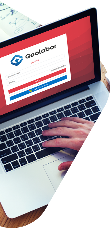
Geolabor is not just a geotechnical and geology data management system. It is a work methodology that offers a complete, constantly improved, solution.
In addition to technology, you have access to:
- Customized implementation with training and assisted operation;
- Real-time support;
- Customer Success focused on maximizing results, periodic monitoring meetings, and analysis reports on quality and information.

Geolabor is present in the daily lives of Geotechnical professionals to facilitate their work in the field, laboratory, and data analysis.
Here are some figures from Geolabor’s history
tests carried out
samples collected
completed daily log book
processed field investigations
Geotechnical Community
Stockpile and dam construction Geotechnical data Have undergone digitalization, and over the last few years, they have become prominent topics in mining...
Information security is essential for a company’s success, especially when data entry has become indispensable. Furthermore, data protection is a fundamental pillar...
This study aims to statistically analyze the variation in adherence to technical specification criteria in the quality assurance and quality control of...
Frequently Asked Questions
Does Geolabor work without internet access?
Yes! Geolabor has an offline-first mobile application, designed for <i>in situ</i>. Because of its technology, it works normally on remote and without reception areas. Its objective is to provide a work tool to field users so that they can, in real time, create layers, record sample collections, insert photos, carry out field tests, fill out survey reports, prepare daily log books, check acceptance criteria, etc.
Can I have real-time access to operations?
Yes, it is possible to have real-time access to operations, as long as there is an internet reception in the work areas. The information is automatically synchronized and made available to interested parties, who can then monitor operations remotely.
How is data stored in Geolabor?
If the user is working with Geolabor applications on a notebook or tablet connected to a network, all uploaded data into Geolabor is automatically and immediately stored in Geolabor environments in the AWS cloud, eliminating the risk of data loss.
When the user is working with the Geolabor Field application on a mobile device without a momentary internet reception, the data is kept in the device’s cache until it finds some network or wi-fi.
When the device finally connects to a network, the application will connect to AWS servers and automatically upload the data to the cloud without user intervention.
Can I integrate the Geolabor database with any Business Intelligence tool?
Geolabor offers a database exclusively dedicated to integration with Business Intelligence tools. It maps and organizes system data, facilitating connection to BI solutions that benefit from efficient, high-performance integration.
How does Geolabor implementation work?
The implementation consists of setting the environment for the client, system parameterization, training, and assisted operation. These steps prepare the system to receive data according to desired standards while enabling the client’s team and suppliers to use the system correctly, completely, and autonomously.
How does the monitoring and support service work?
To make the most of Geolabor, the Customer Success team monitors projects and generates reports highlighting pending issues, opportunities for improvement, and possible errors in data entry. The dashboard is monthly presented to the client, along with relevant insights into their strategy.
Each customer usage context builds the analysis. We define the control items that will be monitored, and the analysis result will indicate the maturity degree of the software’s usage along with the opportunities to achieve the best performance.











Testimonials about Geolabor

